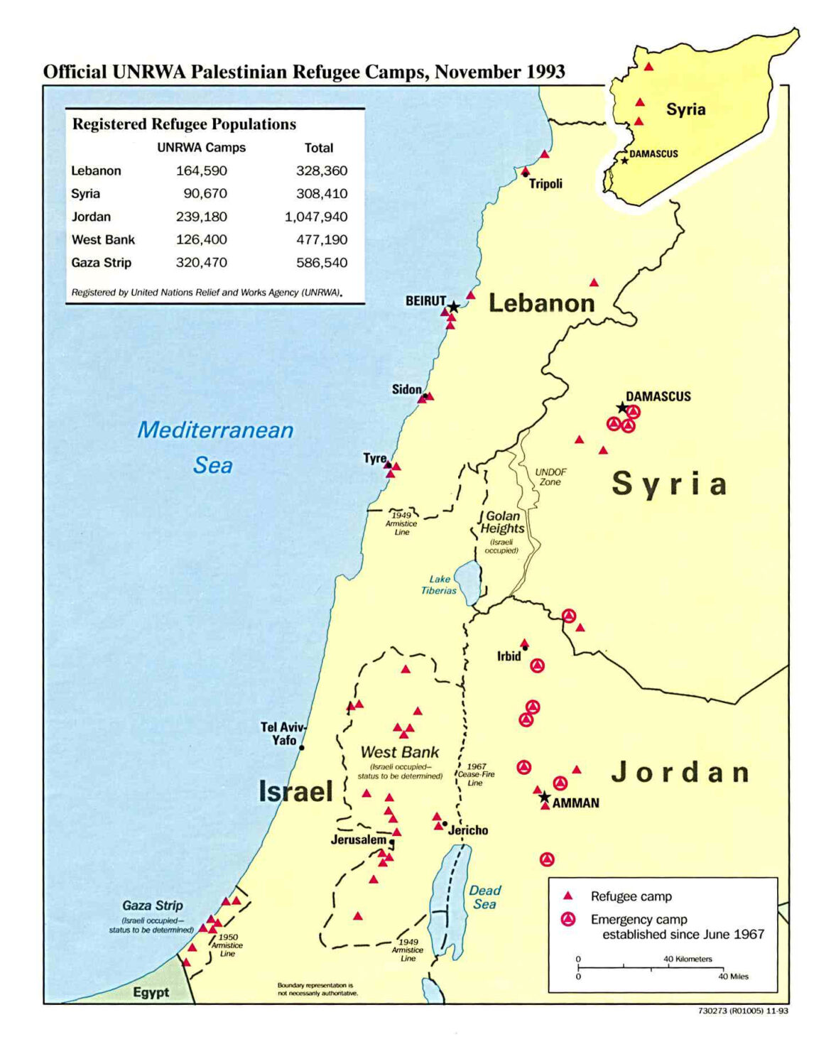
Maps of Palestine and Israel provide a vivid representation of shifting borders and changing landscapes. Examining these historical maps through a Christian perspective offers a profound opportunity to understand the theological and cultural implications of territorial transitions. The land, revered for its biblical significance, has been at the epicenter of divine promises, conflicts, and intricate sociopolitical narratives that resonate through centuries.
The borders of Palestine and Israel have transformed significantly over time, influenced by various empires and cultures. From the ancient period to the present day, the territory has been a tapestry of dramatic stories and relentless change. Initially, the area known today as Israel and Palestine was a cradle of early civilization where various tribes, including the Israelites, flourished. The land itself became synonymous with divine promise, manifesting God’s covenant with Abraham, Isaac, and Jacob, a cornerstone belief within Christianity.
As we embark on a historical journey, we begin in antiquity, when the Twelve Tribes of Israel settled in Canaan, a land overflowing with divine promise. The geographical context of this period is essential for recognizing the theological significance attributed to the land. The borders during this time were not as clearly defined as today but were marked by significant cities and landmarks, each bearing a story integral to the biblical narrative. Cities such as Jerusalem, Hebron, and Bethlehem serve as focal points of pilgrimage and faith for Christians, deeply rooting the sanctity of the land in spiritual consciousness.
With the rise and fall of empires, the map of Palestine evolved dramatically. The Assyrian, Babylonian, and Persian empires exerted influence and control over the region, culminating in the establishment of Roman dominion. This era witnessed profound shifts not just in borders but also in cultural and religious dynamics, as Christianity emerged in the very heart of this contentious environment. The destruction of the Second Temple in 70 CE marked a watershed moment, influencing both Jewish and Christian identities. In the centuries that followed, the Byzantine Empire would subsequently assert its authority, further complicating the narrative surrounding the land.
The advent of Islamic expansion in the 7th century heralded yet another significant transformation, as the Islamic Caliphates established control over the region. The incorporation of Islamic teachings and culture introduced unique dimensions to the religious landscape. For Christians, the equation became increasingly intricate as faith lines blurred and theological dialogues emerged. With the Crusades in the medieval period, competing claims to the land ignited fierce conflicts, illustrating the fierce passion that accompanies religious conviction. Maps from this era echo the ambitions of European powers anxious to reclaim what they deemed sacred territory.
The Ottoman Empire dominated the region from the early 16th century until the end of World War I, which laid a foundational stage for contemporary geopolitical issues. Ottoman maps exhibit a period of relative stability where cultural and religious coexistence prevailed, albeit with underlying tensions. The dissolution of the Empire precipitated a scramble for influence, paving the way for the British mandate over Palestine, an epoch fraught with complications and aspirations, particularly concerning the Jewish diaspora seeking refuge and a homeland after centuries of persecution.
The Balfour Declaration in 1917 shifted the narrative once more, igniting hopes for a Jewish homeland while simultaneously heightening uncertainty among the Arab population. This declaration catalyzed a seismic shift in the demographic and political fabric of the region. The subsequent establishment of the State of Israel in 1948 and the ensuing wars transformed the terrain and delineated new boundaries, introducing a persistent and often violent struggle for identity, territorial integrity, and recognition. Maps from this period depicted displacements and newfound borders, serving as stark reminders of human struggles amidst divine narratives.
From a Christian perspective, these territorial transitions are imbued with deeper spiritual significance. The land remains an everlasting testament to God’s promises, a region where faith was anchored for millennia. The prophetic significance of the land plays a crucial role in Christian eschatology, prompting reflections on themes of restoration and reconciliation. The land’s enduring tumultuous history raises vital questions about moral imperatives and the Christian call toward peacemaking and justice.
The complexities surrounding Palestine and Israel elucidate the need for a compassionate lens when interpreting contemporary conflicts. Engaging with historical maps reveals not only the shifting borders but the deeper narratives of faith, suffering, and hope. Each line redrawn on a map becomes a reflection of people’s aspirations, heartbreaks, and relentless pursuit of meaning intertwined with divine fulfillment. Understanding these transformations compels the Christian community to explore its role in the ongoing discourse surrounding peace and coexistence in this contested land.
In conclusion, the exploration of the Palestine–Israel map over time unveils a rich tapestry of history interwoven with theological significance. Each map reflects human endeavors, divine promises, and the complexities of faith in a land that holds a place at the heart of Christianity. As borders shift, so too do our perspectives. The call for curiosity and deep engagement with both history and theology remains ever pertinent, encouraging dialogue grounded in love, understanding, and the hope for reconciliation.


