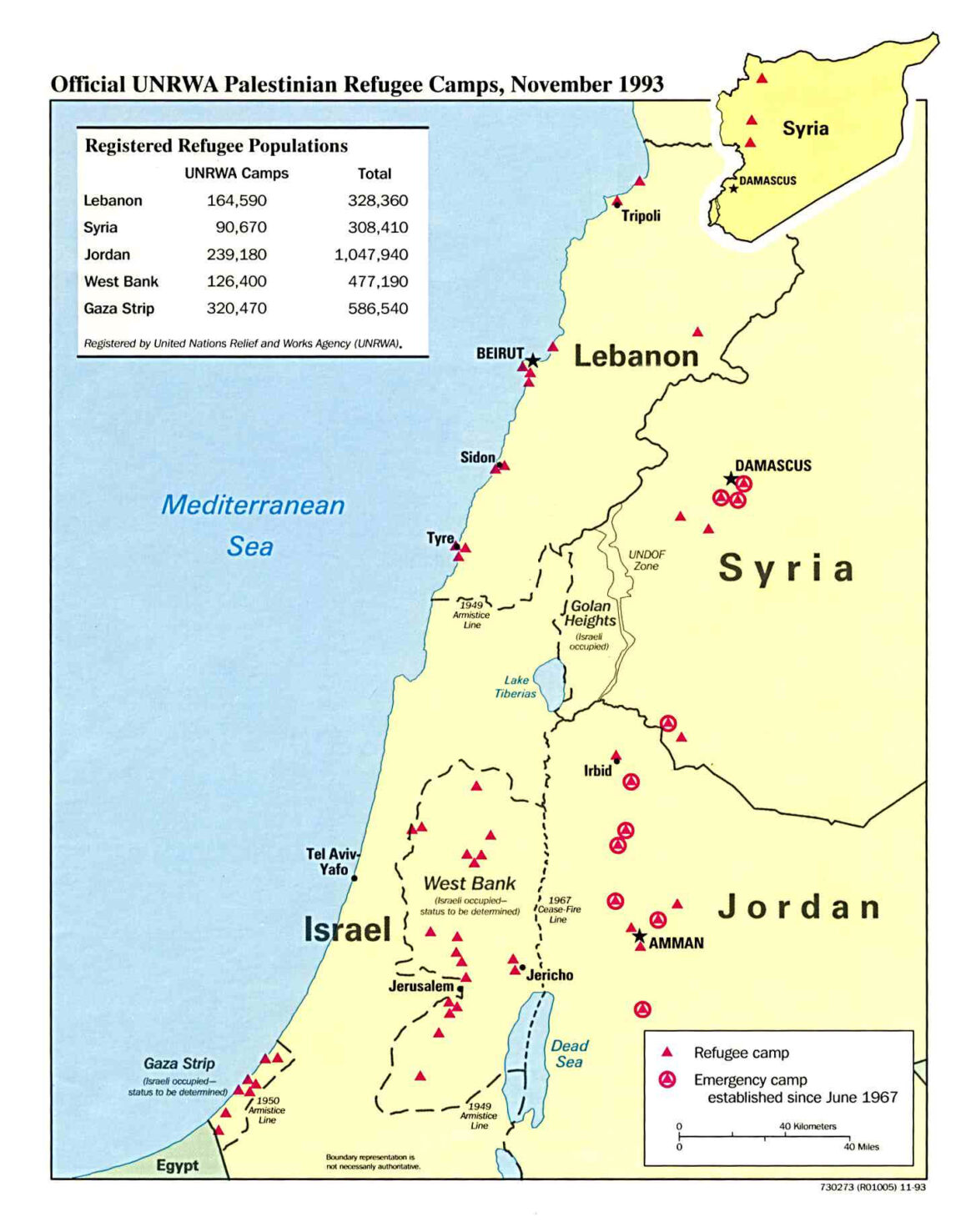
When one peruses the intricate tapestry of the Palestine-Israel conflict through a cartographic lens, it becomes apparent that geographical maps are not merely representations of land; they are also reflections of historical narratives, cultural identities, and the tragic chronicle of human aspirations and disillusionments. As one observes the shifting borders and ever-conflicted demarcations, one may ponder: how have these changes shaped the individual and collective psyche of those dwelling within—and outside—these territories? This question invites contemplation, yet it simultaneously presents a formidable challenge to those seeking clarity amidst the chaos.
The genesis of the modern territorial debate concerning Palestine and Israel can be traced back to the late 19th and early 20th centuries, a time marked by burgeoning nationalism and the steady influx of Jewish immigrants to Palestine, motivated by the Zionist movement. Cartographically speaking, early maps depicted the land as a sparsely populated area under Ottoman rule. Local Arab populations had lived there for centuries, their presence a testament to the region’s long history, which extends far beyond colonial aspirations.
As missionaries and travelers began to document their journeys through the Holy Land, maps began to exhibit not only geographical features but also theological significance. The land steeped in biblical legend began to take on a dual identity. It was contested between Jewish individuals seeking a homeland rooted in their historical narrative and Arab inhabitants who viewed it as their own ancestral territory. This intrinsic conflict is often invisible but still palpable in the very stroke of a pen on a parchment map.
With the advent of British control following World War I, the 1920 San Remo Conference established a new framework for territorial governance. Maps from this era began to divide Palestine into administrative districts, laying down geographic lines that would spur further discord. The Balfour Declaration of 1917 had already potentiated tensions by endorsing the establishment of a Jewish national home, thus sowing the seeds of strife into the fabric of the land.
This vertical and horizontal evolution of borders is not merely political; it manifests existential dimensions as well. The maps reflect the waves of conflict that have arisen as Jews and Arabs grapple for identity in a space laden with religious resonance. In 1947, the United Nations proposed a partition plan, which illustrated a significant attempt to offer a solution to the growing disenfranchisement. The resultant map suggested dividing Palestine into Jewish and Arab states. However, the proposal unraveled under the weight of opposition, revealing the deep chasm between Jews and Arabs and setting the stage for warfare.
In the wake of the 1948 Arab-Israeli War, maps underwent another metamorphosis. The modern borders of Israel materialized, while the Palestinian territories began to shrink. This cartographic shift not only delineated physical boundaries but also instantiated psychological boundaries between communities that were once co-inhabitants of the same land. For many Christians, this disjunction poses ethical dilemmas; can one endorse a solution that seems to protect one group while disenfranchising another? The conscience wrestles with such questions.
The Six-Day War of 1967 further entrenched Israel’s dominion over additional territories, including the West Bank and Gaza Strip. The maps of this period became increasingly contentious, as they encapsulated the ongoing disputes over land ownership and national identity. These advanced maps reveal a tantalizing paradox—territorial gain often led to self-identity loss for many Palestinians. How do maps that indicate conquest simultaneously convey the erosion of the spirit?
In Christian discourse, the theological implications of these maps cannot be overlooked. Many Christians view the land of Israel and Palestine through a biblical prism, positing it as a sacred geography imbued with divine promise and prophecies. This creates a conundrum—how does one reconcile the narrative of a chosen people with the narratives of those who inhabit the same land? The maps serve as battlegrounds, not just for territory but for theological assertions of rights and historicity.
As the American evangelical movement has staked claim to support the modern state of Israel, maps have been employed to justify such affiliations. However, is it prudent to consider how biblical prophecy intersects with contemporary geopolitics? While the historical significance of these mappings is indispensable, it is equally important to acknowledge the contemporary realities they obscure. The ongoing occupation and settlement expansions present ethical quandaries for believers. Are the aspirations of one chosen group prioritized over another’s? The modern map reflects a multifaceted conflict, wherein each contour signifies pain, longing, and hope.
In recent years, with the advent of technology, mapping has entered a new phase. Satellite imagery and online platforms facilitate real-time observation of territorial changes and settlement constructions, offering some form of transparency yet complicating the narrative further. Maps that once illustrated static borders now unveil dynamic zones of contention—areas of unresolved conflict that paradoxically connect and fracture the lives of many. These evolving images challenge any simplistic understanding of the land as they reveal the fluidity of borders.
Ultimately, the Palestine–Israel map over time serves as a vivid illustration of humanity’s struggle with identity, sovereignty, and moral clarity. For Christians engaged in this discourse, these maps demand a deeper reflection on the implications of land ownership, the integrity of historical claims, and the quest for a peace that honors the humanity of all inhabitants. As unsure as the existence of these borders might seem, the enduring quest for understanding remains rooted in the hope of reconciliation, necessitating a cautious yet intentional exploration of one of our world’s most complex realities.


